UN
1 Box Road
£ 165,000
Description
We don't have a Description for this property.
- Bedrooms
- 4
- Bathrooms
- 0
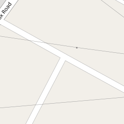

Leaflet © OpenStreetMap contributors
The heatmap indicates the level of crime in the area. The color of the heatmap indicates the crime severity and recency.
Metrics Year-on-Year
- Average area value
- 251,538.00 £Increased by 21.55 %
- Average area rental value
- 754.00 £/moDecreased by 18.22 %
- Est rental Yield
- 3.60 %Decreased by 32.71 %
- Crime Rate
- 71.00 %Unchanged by 0.00 %
from 206,948.00 £
from 922.00 £/mo
from 5.35 %
from 71.00 %
Nearby Schools
| Name | Type | Ofsted | Distance |
|---|---|---|---|
| Slimbridge Primary School | Community School | Good | 1.61 KM |
| Cam Hopton Church Of England Primary School | Voluntary Aided School | Good | 2.11 KM |
| Cam Everlands Primary School | Community School | Good | 2.19 KM |
| Cam Woodfield Junior School | Academy Sponsor Led | 2.33 KM | |
| Cam Woodfield Infant School | Community School | Good | 2.33 KM |
Images
Nearby Streets
| Name | Average Price | Average Sqft | Distance |
|---|---|---|---|
| Whatling Way | £ 226,875 | 0 | 0.00 KM |
| Brunel Road | £ 445,000 | 0 | 0.00 KM |
| Pippen Leaze | £ 452,500 | 0 | 0.00 KM |
| Barley Close | £ 472,500 | 0 | 0.00 KM |
| Otter Way | £ 0 | 0 | 0.00 KM |
Nearby Transport
| Name | NLC | TLC | Distance |
|---|---|---|---|
| Cam And Dursley | 3238 | CDU | 0.56 KM |
| Stonehouse | 4770 | SHU | 9.87 KM |
Nearby Listings
| Address | Price | Type | Score | Distance |
|---|---|---|---|---|
| Box Road, Cam | £ 315,000 | BUY | 7 / 10 | 0.07 KM |
| Box Road Avenue, Cam, Dursley | £ 325,000 | BUY | 7 / 10 | 0.08 KM |
| Box Road, Cam, Dursley | £ 355,000 | BUY | 6 / 10 | 0.11 KM |
| Box Road Avenue, Cam | £ 325,000 | BUY | 7 / 10 | 0.12 KM |
| Box Road, Cam | £ 420,000 | BUY | 7 / 10 | 0.16 KM |
Nearby Properties
| Address | Price | Distance |
|---|---|---|
| 2 Box Road | £ 250,000 | 0.00 KM |
| 21 Box Road | £ 305,000 | 0.00 KM |
| 1 Box Road | £ 165,000 | 0.00 KM |
| 9 Box Road | £ 240,000 | 0.00 KM |
| 29 Box Road | £ 237,000 | 0.02 KM |